What is an integrated crisis response system?
An integrated crisis response system (ICRS) is a coordinated network of people, processes, technology, and information designed to manage emergencies from detection to recovery. Instead of isolated teams acting independently, an ICRS links public agencies, private‑sector partners, NGOs, and critical infrastructure operators through shared protocols and real‑time data streams. The goal is to reduce duplication, accelerate decision making, and deliver aid where it is needed most.
Key components of an ICRS
Every functional system contains four layers that interact continuously:
- Governance and policy. Legal authority, roles, and escalation procedures that define who leads and how decisions are approved.
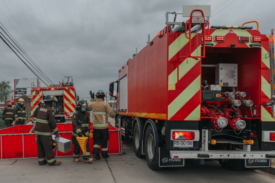
- People and organization. Incident managers, field responders, analysts, and support staff, organized into clear command structures.
- Technology and data. Sensors, communication platforms, situational‑awareness dashboards, and data‑fusion tools that turn raw information into actionable intelligence.
- Processes and procedures. Standard operating procedures (SOPs), checklists, and after‑action review cycles that keep the system consistent and learn from each event.
How the system is activated
Activation begins with a “trigger.” Triggers can be automatic—such as a seismic sensor crossing a magnitude threshold—or manual, like a mayor declaring an emergency. The trigger feeds into a central coordination hub, often called the Emergency Operations Center (EOC) or Joint Operations Center (JOC). The hub validates the alert, determines the appropriate response level, and notifies all pre‑registered participants.
Step‑by‑step activation flow
- Detection. Sensors, social‑media monitoring, or first‑responder calls generate an incident signal.
- Verification. An analyst cross‑checks the signal against other sources (e.g., satellite imagery, weather forecasts) to confirm severity.
- Classification. The incident is assigned a level (e.g., Level 1 – localized, Level 3 – regional) based on impact criteria.
- Notification. Automated alerts are sent via the common operating picture (COP) platform to all stakeholders.
- Mobilization. Pre‑positioned resources—personnel, equipment, supplies—are dispatched according to pre‑defined taskings.
Communication architecture
Effective communication is the spine of integration. Most ICRS implementations rely on a layered approach:
- Primary radio and broadband. Dedicated, interoperable radio bands (e.g., P25, TETRA) for voice traffic, backed by secure broadband for data sharing.
- Incident‑specific network. A virtual LAN created for the duration of the event, allowing responders to share maps, images, and status reports in real time.
- Public information channel. A separate stream for alerts to the public, coordinated with media partners and social‑media tools.
The system uses a “push‑pull” model. Critical alerts are pushed automatically to all users, while analysts can pull detailed data (e.g., GIS layers, hospital capacity reports) as needed.
Data fusion and situational awareness
Raw data from diverse sources—weather radars, traffic cameras, hospital information systems, and citizen reports—arrive in different formats and time scales. An ICRS employs a data‑fusion engine that normalises, geo‑references, and timestamps each input before it appears on the shared dashboard.
Typical data feeds
| Source | Data type | Frequency |
|---|---|---|
| Seismic network | Ground motion values | Instant (seconds) |
| Weather service | Forecast, wind, rainfall | Hourly |
| Satellite imagery | Visible/infrared | Every 15‑30 min (depending on orbit) |
| Hospital EHR | Bed occupancy, triage counts | Every 5 min |
| Social media monitoring | Geo‑tagged posts, photos | Real‑time |
Analysts use heat‑maps, resource‑allocation overlays, and predictive models to anticipate where the situation may evolve. The dashboard also flags “information gaps” so that field teams can be tasked to collect missing data.
Resource management and logistics
When an incident escalates, the system must track who has what, where it is, and when it will be needed. Integrated logistics modules link inventory databases of multiple agencies, enabling “just‑in‑time” deployment.
Inventory pooling
- Public health agencies share stockpiles of N95 masks, vaccines, and antiviral meds.
- Transportation departments list spare heavy‑equipment (e.g., cranes, high‑water vehicles) that can be borrowed.
- Non‑profits maintain caches of food, water, and shelter kits that are automatically visible to the EOC.
Dynamic allocation
As the incident map updates, the system suggests optimal routes and load‑balancing options. For example, if a flood blocks Highway 12, the platform reroutes supply trucks to use Highway 7 and notifies the driver via a mobile app. The system also records actual consumption, feeding back into demand forecasts for the next 24‑48 hours.
Decision‑making hierarchy
Integrated response does not eliminate hierarchy; it clarifies who makes which decisions and when they can be overridden. Most frameworks adopt an Incident Command System (ICS) or a similar modular structure. The hierarchy typically includes:
- Strategic level. Elected officials or agency heads set overall objectives (e.g., “protect all hospitals”).
- Tactical level. Incident commanders translate objectives into operational plans (e.g., “deploy 20 EMS units to Zone A”).
- Operational level. Field supervisors monitor execution and adjust tasks in real time.
The shared platform captures every decision, timestamps it, and makes it visible to the entire chain. This transparency reduces the “silo” effect and enables rapid reprioritisation when conditions change.
Coordination with external partners
Crises rarely respect jurisdictional boundaries. An ICRS therefore contains predefined partnership agreements—Memoranda of Understanding (MOUs), mutual‑aid compacts, and data‑sharing accords—that activate automatically.
Case example: Wildfire across three counties
County A’s fire department detects a rapidly spreading blaze. The incident triggers a Level 2 response. Because an MOU exists with neighboring Counties B and C, the system instantly shares fire perimeter maps, aerial‑asset availability, and evacuation routes. County B contributes a water‑dropping helicopter; County C provides a mobile command trailer. All assets appear on the joint dashboard, and each jurisdiction’s incident commander can re‑task resources without waiting for a separate phone call.
Public communication and information management
Keeping the public informed is both a protective measure and a demand‑management tool. An integrated system uses a dedicated Public Information Officer (PIO) module that pulls verified alerts from the EOC and republishes them through:
- Emergency alert text messages (e.g., Wireless Emergency Alerts)
- Official social‑media accounts
- Local broadcast partnerships
- Dynamic maps on municipal websites
The system logs the time each message is sent and monitors feedback (e.g., inbound calls, social‑media sentiment) to gauge comprehension and adjust messaging.
Training, exercises, and continuous improvement
Integration only works if participants practice together. Most jurisdictions schedule quarterly tabletop exercises and annual full‑scale drills. During an exercise, the same technology stack is used, but simulated data replaces live feeds. After the event, an after‑action review (AAR) captures:
- What worked as designed
- Where communication broke down
- Data gaps that slowed decision making
- Updates needed to SOPs or technical configurations
Lessons feed back into the system through a formal change‑management workflow, ensuring that the next real incident benefits from the recent learning.
Challenges and how they are addressed
Even a well‑designed ICRS encounters practical obstacles. Common issues and mitigations include:
- Interoperability. Older radio fleets may not speak the same digital protocol. Solution: Deploy gateway devices that translate between legacy and modern systems.
- Data overload. Analysts can be swamped by too many feeds. Solution: Use machine‑learning classifiers to flag high‑priority items and suppress noise.
- Jurisdictional resistance. Agencies may fear loss of control. Solution: Build governance agreements that preserve local authority while granting access to shared resources.
- Cybersecurity. Centralized platforms attract attackers. Solution: Implement multi‑factor authentication, network segmentation, and regular penetration testing.
- Resource scarcity. Not all assets can be pre‑positioned. Solution: Adopt “flex‑stock” concepts—contracts with private logistics firms that guarantee rapid mobilization when needed.
Technology standards commonly used
Standardisation makes integration easier across agencies and vendors. The most widely adopted specifications are:
- NIEM (National Information Exchange Model). Defines data‑exchange formats for emergency management.
- CAP (Common Alerting Protocol). Enables consistent alert messages across multiple dissemination channels.
- OGC standards (Open Geospatial Consortium). Provide common GIS data structures for mapping.
- IEC 60870‑5‑104. Used for SCADA communication with critical infrastructure (e.g., power grids).
Real‑world example: Integrated response to a coastal hurricane
When Hurricane Lydia made landfall on a Gulf‑Coast state, the integrated system demonstrated its full lifecycle:
- Pre‑event. Seasonal forecasts entered the platform, prompting pre‑positioning of sandbags, generators, and evacuation shelters.
- Impact. The radar network reported a wind gust of 120 mph. The EOC received an automatic CAP alert, classified the event as Level 3, and activated the joint command.
- Response. The system displayed real‑time flood‑extent maps derived from satellite and drone imagery. Emergency medical services were routed around flooded roadways using dynamic traffic data. Power‑outage estimates from the utility’s SCADA system helped prioritize crew deployment.
- Recovery. After the storm passed, damage assessments collected via mobile inspection apps fed directly into a recovery dashboard. Funding requests for debris removal were generated automatically from the verified damage data.
The coordinated approach reduced duplicated trips, cut shelter wait times by 30 percent, and allowed the state to submit a complete FEMA damage report within the required 60‑day window.
Future‑proofing an integrated system
While the article does not speculate on unproven technologies, it is prudent to design for scalability. Key practices include:
- Modular architecture—add new sensor types or partner portals without redesigning the core platform.
- Open‑source components—avoid vendor lock‑in and allow community‑driven security updates.
- Cloud‑ready deployment—use hybrid clouds to expand compute capacity during peak events while keeping critical functions on‑premises for resilience.